U.S. Weather/Crop Progress


Highlights:
- 19% of the corn is now mature, up 8 points from last week, 4 points ahead of last year and 6 points ahead of the 5-yr average. Sorghum harvest is at 19%, 1 points ahead of last year and 1 point behind the 5-year average. Barley harvest is now 75% completed, up 28 points from last week, even with last year and 1 point behind the 5-year average. Soybean leaf drop is at 13%, up 7 points from last week, even with last year, but 3 points ahead of the 5-year average.
- The corn crop condition held steady this week with the Good/Excellent rating at 65%. A fall-off in crop condition with some hot, dry weather in the Midwest and Plains states would be seasonally normal. Sorghum condition improved 2 points with the G/E category at 50%. 19% of sorghum is now rated poor to very poor condition due to excessive heat and dryness. The soybean condition rating fell 2 points to 65% G/E. Four states (Arkansas, Iowa, Louisiana, and Missouri) still have soybean G/E ratings above 70.
- In the West, showers are limited to the central Rockies. Hot, dry weather covers the remainder of the western U.S., with Thursday’s high temperatures expected to top 115°F in parts of the Desert Southwest. Readings near 100°F will reach into parts of the Northwest, where several large wildfires are resulting in reductions in visibility and poor air quality.
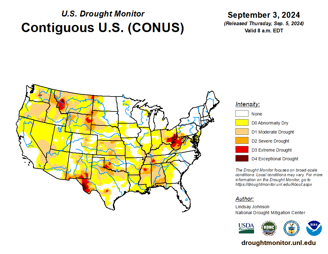
- On the Plains, cooler air is overspreading the Dakotas and environs, while warm, mostly dry weather across the remainder of the nation’s mid-section is ideal for summer crop maturation and harvesting. However, soil moisture is lacking in some areas as producers begin to plant winter wheat. On September 1, USDA/NASS reported that topsoil moisture was rated more than one-half very short to short in Texas (79%), Montana (77%), Colorado (65%), and Kansas (51%).
- In the Corn Belt, warmth in advance of an approaching cold front prevails across the southeastern half of the region, with today’s high temperatures expected to top 90°F in parts of the middle Mississippi Valley. The warmth is hastening corn and soybean maturation—but maintaining stress on immature crops. Meanwhile, cooler air is overspreading the northwestern Corn Belt, with showers mostly limited to the upper Great Lakes region.
- In the South, a disorganized low-pressure system over the northwestern Gulf of Mexico is helping to focus local downpours, which are heaviest in the central Gulf Coast region and along the upper Texas coast. Showers also extend eastward to the southern Atlantic Coast. Across the remainder of the South, warm, dry weather is promoting summer crop maturation and harvesting.
Outlook:
A cold front currently extending southwestward from the Great Lakes States will press eastward, reaching the Atlantic Seaboard during the weekend. Briefly heavy showers may accompany the front in parts of the Great Lakes and Northeastern States. Cool air in the front’s wake will lead to widespread weekend temperatures below 50°F in the Midwest, with scattered frost possible in the upper Great Lakes region, well outside any major corn and soybean production areas. Meanwhile, wet weather will continue across the Deep South, with 5-day rainfall totals possibly reaching 2 to 6 inches or more from coastal Texas to the southern Atlantic Coast. However, there will be a sharp northern cutoff to any rain, with mostly dry weather expected from the northern Mississippi Delta to the middle Atlantic States. Elsewhere, a spell of hot, dry weather will cover much of the western half of the U.S., with record-setting high temperatures expected through the weekend as far north as the northern High Plains and the interior Northwest. The NWS 6- to 10-day outlook for September 10 – 14 calls for the likelihood of near- or above-normal temperatures and near- or below-normal rainfall across most of the country. Cooler-than- normal conditions will be confined to the South, excluding Florida’s peninsula, while wetter-than-normal weather should be limited to northern California, the Northwest, and an area stretching from coastal Texas to the southern Atlantic Coast.

