U.S. Weather/Crop Progress

Highlights:
- Good planting progress was made for barley. Planting progress for corn, soybeans, and sorghum slowed down last week and are all now behind last year’s planting pace although still slightly ahead of the 5-year average. With rainfall present across much of the Midwest this week, expect minor progress in planting progress in next week’s report.
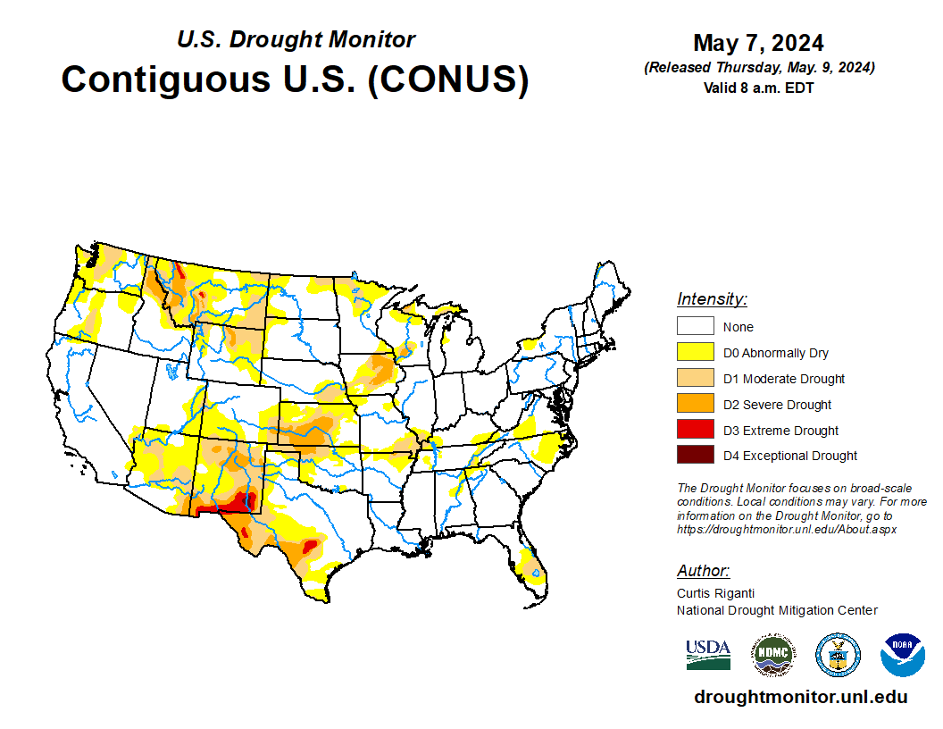
- In the West, late-season snow is blanketing the eastern slopes of the northern Rockies. Cooler-than-normal conditions continue to dominate the West, with freezes reported early Wednesday in several places, including agricultural areas of west-central Colorado. However, dry weather across much of the West favors spring fieldwork.
- In the Plains, cool weather prevails across the northwestern half of the region. In fact, Wednesday’s high temperatures will remain below 50°F in parts of Montana, where ongoing precipitation (rain and wet snow) has halted fieldwork but is benefiting rangeland, pastures, winter wheat, and emerging summer crops. Scattered freezes were noted as far south as the central High Plains, including parts of eastern Colorado.
- In the Corn Belt, warm, humid weather lingers across the Ohio Valley. Meanwhile, somewhat cooler, drier air is overspreading the remainder of the Midwest, although some communities are still recovering from recent severe weather outbreaks. Thunderstorms on Tuesday spawned several tornadoes in Indiana, Ohio, and southern Michigan.
- In the South, a few thunderstorms are affecting the northern Mississippi Delta and the Tennessee Valley. Later today, thunderstorms in the mid-South and environs could become severe, with wind, hail, and isolated tornadoes. However, the bulk of the South is experiencing warm, dry weather, which is promoting fieldwork and crop development. In Florida, where topsoil moisture was rated 43% very short to short on May 5, irrigation demands for citrus are increasing.
Outlook:
Prior to an upcoming pattern change, atmospheric disturbances will continue to generate scattered to widespread showers from the Rockies to the Atlantic Coast. Some of the heaviest rain, locally 1 to 3 inches or more, will fall across the South, starting Wednesday and lasting into Friday. A few thunderstorms may contain large hail and damaging winds, with the main threat of severe weather shifting southward and eastward over the next couple of days. Meanwhile, west of the Rockies, mostly dry weather will accompany a warming trend. As Western warmth develops, somewhat cooler, drier air will gradually overspread the central and eastern U.S. By week’s end, lingering showers should be confined to the Ohio Valley and Northeast, although a new area of rain may develop across southern sections of the Rockies and High Plains. The NWS 6- to 10-day outlook for May 13 – 17 calls for near- or above-normal temperatures nationwide, with the greatest likelihood of warm weather stretching from northern and central California to the northern section of the Rockies and High Plains. Meanwhile, above-normal precipitation across most of the country should contrast with drier-than-normal conditions from the Pacific Northwest to the northern Rockies.

