U.S. Weather/Crop Progress
Highlights:
- In the West, any lingering snow showers are generally confined to the Rockies. Meanwhile, temperatures are slowly rebounding to near-normal temperatures in advance of Pacific storminess.
- In the Plains states, chilly conditions prevail in the wake of recent storminess. A variable snow cover exists across the northern half of the Plains, providing winter wheat with some insulation from temperatures that generally ranged from 0 to 20°F. A few sub-zero readings were noted Wednesday morning in the Dakotas, while freezing temperatures were observed as far south as the Texas Panhandle. In Kansas, 7% of the winter wheat was jointing by March 24, along with 36% of the crop in Oklahoma.
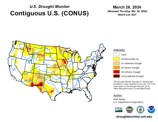
- In the Corn Belt, snow showers are confined to the upper Great Lakes region. Elsewhere, breezy, dry weather prevails. Snow remains on the ground in some of the previously driest areas of the upper Midwest, with that snow expected to boost topsoil moisture as it melts.
- In the South, scattered showers stretch from Virginia to northern Florida. Elsewhere, dry weather favors fieldwork, including planting activities as conditions permit in the wake of recent rainfall. By March 24 in Texas, 46% of the intended corn acreage had been planted, along with 37% of the sorghum and 20% of the rice.
Outlook:
Rain will linger along the Atlantic Coast through Thursday, with parts of New England experiencing a rain-to-snow transition on Friday. Meanwhile, freezes will occur on Thursday morning in most areas north of a line from the Texas Panhandle to the Ohio River. By Friday morning, scattered frost may occur across the interior Southeast. Farther west, Pacific storminess will initially affect the northern half of the western U.S. By Friday, however, the focus for stormy weather will shift into California. During the weekend, precipitation will spread farther inland across the Great Basin, Intermountain West, and parts of the Southwest.
By early next week, precipitation will return across the nation’s mid-section, especially extending eastward from Wyoming, Nebraska, and South Dakota. The NWS 6- to 10-day outlook for April 1 – 5 calls for the likelihood of near- or below-normal temperatures nationwide, except for warmer-than-normal weather in the southern Atlantic States and parts of the Northwest. Meanwhile, near- or above-normal precipitation across most of the country should contrast with drier-than-normal conditions in the Pacific Northwest.

