U.S. Weather/Crop Progress
Highlights:
- In the Western U.S., a new storm system is moving inland across the Pacific coast. However, temperatures are above average, limiting snowfall accumulations. The heaviest precipitation is occurring in Pacific Northwest and northern California.
- In the Plains states, mild air overspreading cold ground and lingering snow cover is creating significant fog. The fog is particularly dense across the central and southern Plains, with freezing rain occurring in Kansas and Nebraska. The remaining snow cover is deepest in eastern Nebraska.
- In the Corn Belt, foggy conditions are broadly affecting the region. Precipitation is occurring the strongest in the eastern corn belt, with patchy freezing drizzle in the western Corn Belt. The combination of fog, freezing drizzle, and slushy/muddy roads is affecting travel conditions.
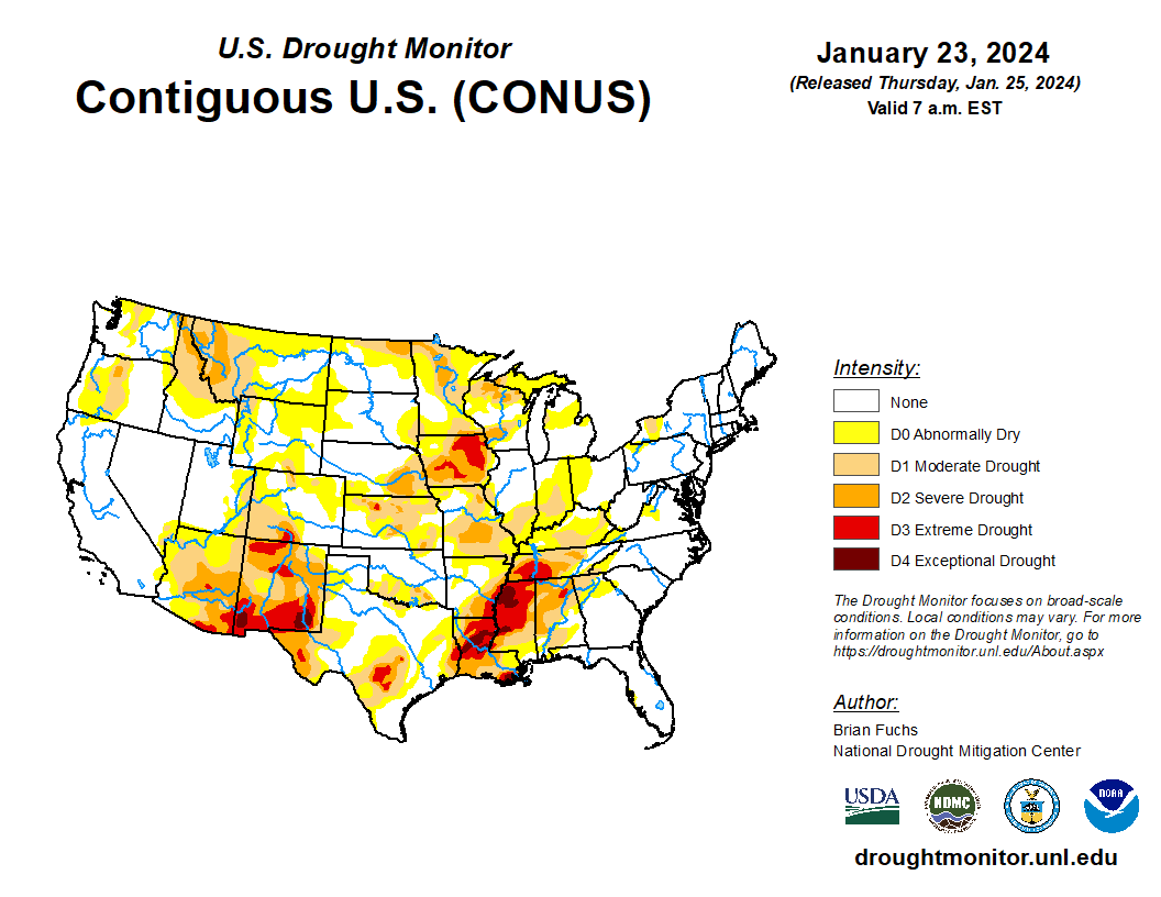
- In the South, significant rainfall from the western Gulf to the Mississippi Delta is resulting in flash flooding. In the Southeast, temperatures have increased to above normal levels, following the recent cold snap.
Outlook: The heavy-rainfall event in the South will continue until Saturday. Additional rainfall could total 2 to 8 inches from the central Gulf Coast States to the central and southern Appalachians, extending as far north as the Ohio Valley. The heavy rain should greatly reduce drought coverage and intensity from the Mississippi Delta into the Tennessee Valley but could lead to flash flooding and river flooding throughout the South. Locally severe thunderstorms may accompany the rain, especially along and near the Gulf Coast.
In contrast, dry weather will prevail for the next 5 days across the northern Plains and far upper Midwest, as well as southern California and the Desert Southwest. Elsewhere, storms will continue to migrate inland across parts of the western U.S., with the heaviest precipitation expected in the Pacific Northwest.
The NWS 6- to 10-day outlook for January 29 – February 2 calls for the likelihood of near or above-normal temperatures nationwide, except for cooler-than-normal conditions across Florida’s peninsula. Meanwhile, above-normal precipitation throughout the southern Plains and the western U.S. should contrast with drier-than-normal weather in most areas from the Mississippi Valley to the Atlantic Coast.