U.S. Weather/Crop Progress


Highlights:
- 21% of the corn is now harvested, up 7 points from last week, steady with last year and 3 points ahead of the 5-yr average. Sorghum harvest is at 35%, 2 points ahead of last year and 3 points ahead of the 5-year average. Barley harvest is now completed. Soybean harvest in now at 26% completed, up 13 points from last week, 6 points ahead of last year and 8 points ahead of the 5-year average.
- The corn crop condition was down 1 point from last week with the Good/Excellent rating at 64%. Sorghum condition was up 1% in the G/E category at 45%, but 23% of sorghum is now rated poor to very poor condition due to excessive heat and dryness. The soybean condition rating held steady at 64% G/E.
- In the West, cool weather is limited to the northern tier of the region, from the Pacific Northwest to the northern Rockies. Meanwhile, summer-like heat prevails from California to the central and southern Rockies. Although winds are currently light, many areas of the West have not received enough moisture this autumn to end the wildfire season.
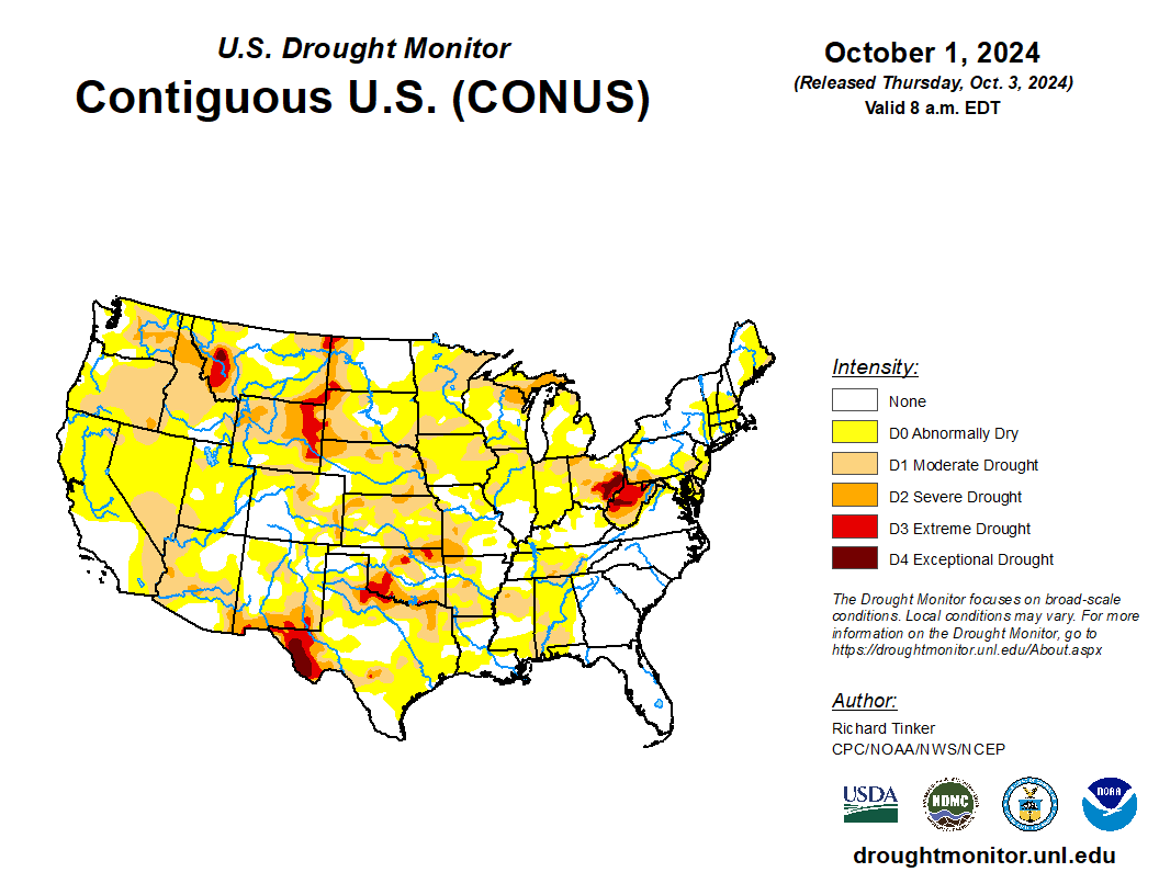
- On the Plains, a dry cold front separates cooler air across the northwestern half of the region from ongoing, late-season heat in much of Kansas, Oklahoma, and Texas. With topsoil moisture (on September 29) rated 50 to 70% very short to short in all Plains States, except North Dakota, producers remain concerned about drought having an adverse impact on winter wheat establishment. However, the dry weather also favors summer crop maturation and harvesting.
- In the Corn Belt, cooler air is overspreading the upper Midwest, while warm, dry weather covers the remainder of the region. Thursday’s high temperatures will approach or reach 90°F in parts of Missouri. On September 29, Minnesota led the Midwest with 35% of its soybean acreage harvested, ahead of the 5-year average of 27%. Meanwhile, the Midwestern corn harvest ranged from 1% complete in North Dakota to 48% complete in Missouri.
- In the South, warm, dry weather prevails, except across parts of Florida. Showers are lurking, however, over the Gulf of Mexico. In the southern Appalachians, post-flood weather remains favorable for search and recovery efforts, although catastrophic damage is complicating access to the hardest-hit areas. Tragically, Hurricane Helene has become the fourth-deadliest U.S. tropical cyclone of the last 60 years, following Maria (Puerto Rico and the U.S. Virgin Islands, 2017); Katrina (U.S. Gulf Coast, including New Orleans, 2005); and Camille (Gulf Coast to Appalachia, 1969).
Outlook:
With late-week winds expected to increase across the northern U.S., an elevated wildfire threat will develop by Friday as far south as the northern Great Basin and as far east as Nebraska and the Dakotas. In fact, large sections of the country—including the Plains and much of the Midwest and West—will experience dry weather during the next 5 days. A few late-week and weekend showers may occur in the Pacific Northwest and Northeast, while Florida’s peninsula will remain wet. Chances of tropical cyclone development over the Gulf of Mexico have slightly diminished, although locally heavy rain may still fall during the next few days along the immediate U.S. Gulf Coast. However, warm, mostly dry weather should prevail in Southeastern flood-recovery areas, with cooler air arriving early next week. The NWS 6- to 10-day outlook for October 8 – 12 calls for the likelihood of near- or above-normal temperatures and near- or below-normal precipitation across much of the country. Cooler-than-normal conditions will be confined to parts of the eastern U.S., mainly from Georgia to New England, while wetter-than-normal weather should be limited to northern Maine; portions of the Pacific Coast States; and the lower Southeast, including Florida’s peninsula.

