U.S. Weather/Crop Progress

Crop Condition Reports not applicable until Spring 2025.
Highlights:
- Essentially the 2024 U.S. corn crop is now harvested with harvested percentage likely above 99%. Sorghum harvest is at 95%, even with last year and 1 point ahead of the 5-year average. Barley harvest is complete. Soybean harvest is now essentially completed.
- Crop condition reports for corn, sorghum, barley and soybeans will not be applicable until Spring 2025. Winter wheat conditions in the U.S. improved with widespread rains in the HRW wheat growing areas. G/E rating is 49% compared to 44% last week and 48% at this time last year, and the Poor/Very Poor group at 15% versus 18% last week and 17% last year.
- In the West, a powerful Pacific storm system continues to pelt northern California with heavy precipitation, including high-elevation snow. Previously, some of the most severe conditions, such as heavy precipitation and high winds, had affected the Pacific Northwest, resulting in Wednesday’s peak of more than 600,000 customers in Washington without electricity. Early Thursday, more than 300,000 customers in Washington remain without power.
- On the Plains, chilly, dry weather prevails. Thursday morning’s minimum temperatures fell below 10°F across portions of the northern Plains, especially in the western Dakotas. Throughout the northern Plains, the cold weather is curtailing further winter wheat development, which in some areas has been limited by drought.
- In the Corn Belt, cool, blustery weather—accompanied by rain and snow showers—is halting final harvest efforts, especially from the Great Lakes States into the Ohio Valley. However, most producers had completed corn and soybean harvesting prior to this latest round of adverse weather conditions. Thursday’s high temperatures will remain below 32°F in the far upper Midwest, including the Red River Valley of the North—but could reach 45°F in the mid-Mississippi Valley.
- In the South, cool, breezy weather prevails in the wake of a cold front’s passage. Given antecedent dryness, any Southern rain that fell in recent days should result in only temporary fieldwork delays. As field conditions permit, producers are planting winter grains and harvesting any remaining summer crops, such as cotton and peanuts.
Outlook:
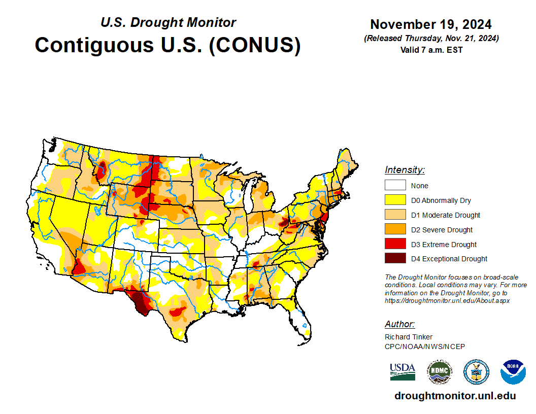
Stormy weather in northern California and the Pacific Northwest will persist into the weekend, with additional precipitation totals of 10 to 15 inches possible in the northern Sierra Nevada and the coastal ranges of northern California. With Western freezing levels expected to rise, the combination of heavy rain and melting snow could lead to locally significant flooding in northern California and environs. Meanwhile, heavy snow will fall as far east as the northern Rockies, although large sections of the nation’s mid-section will remain dry during the next 5 days. Farther east, another slow-moving storm system will maintain unsettled conditions during the next couple of days from the Great Lakes States into the Appalachians and Northeast. Wind-driven snow squalls could lead to some Midwestern and Eastern travel disruptions, especially in the Appalachians, but precipitation in the Northeast should ease drought and will help to extinguish any remaining wildfires. The NWS 6- to 10-day outlook for November 26 – 30 calls for the likelihood of near- or below-normal temperatures nationwide, except for warmer-than-normal weather across the Deep South, from southern New Mexico to the southern Atlantic Coast. Meanwhile, near- or above-normal precipitation across most of the country should contrast with drier-than-normal conditions in a few areas, including the Pacific Northwest and parts of western Texas.

