U.S. Weather/Crop Progress
Highlights:
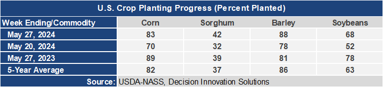
- For a week when there were several storm events across the Midwest, significant planting progress was made for corn and soybeans. Both are now ahead of their 5-year average planting progress. Planting progress for barley and grain sorghum is also ahead of the 5-year average. There is a fairly good window of planting opportunity forecast for this week and progress should be made in the Eastern cornbelt where more corn remains to be planted.
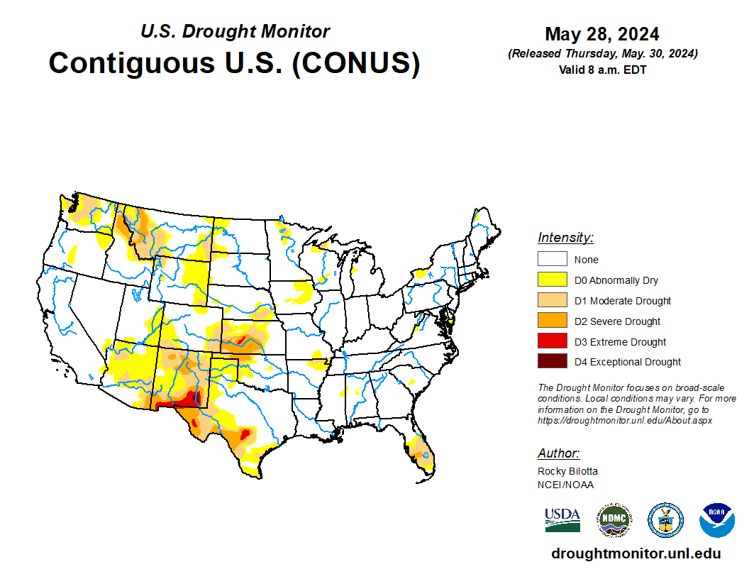
- In the West, cool, showery conditions in the northern Rockies and Pacific Northwest contrast with warm, dry weather from California to the central and southern Rockies. By May 26, Western cotton planting was nearly complete—98 and 97%, respectively, in Arizona and California.
- In the Plains, a cold front arriving in Montana is sparking scattered showers. Meanwhile, Tuesday night thunderstorms across the southern half of the High Plains produced scattered wind and hail damage. Most crop development across the nation’s mid-section remains ahead of the normal pace, with 77% of the nation’s winter wheat headed by May 26, versus the 5-year average of 69%.
- In the Corn Belt, any showers are limited to the lower Great Lakes region. Elsewhere, cool but dry weather is nearly ideal for producers attempting to complete spring planting. By May 26, only 17% of the nation’s intended corn acreage had not yet been planted, along with 32% of the soybeans. Still, some areas remain too wet for planting, with topsoil rated at least 20% surplus in eight Midwestern States on May 26, led by Wisconsin at 35%.
- In the South, southern Florida remains one of the region’s few dry spots, with statewide topsoil moisture rated 30% very short to short on May 26. Meanwhile, showers and thunderstorms dot the western Gulf Coast region. Elsewhere, warm, dry weather favors fieldwork and crop development. National planting progress for all major Southern crops remains ahead of the normal pace, except for peanuts—67% planted on May 26, compared to the 5-year average of 71%.
Outlook:
A multi-day outbreak of severe weather is underway across the nation’s mid-section, as a disturbance arriving from the Northwest interacts with residual moisture and a pair of frontal boundaries. Starting Wednesday, severe thunderstorms may target the northern and central High Plains, with activity gradually shifting southward as the week progresses. Additional strong storms may flare across the High Plains late in the week and during the weekend. Five-day rainfall totals could reach 2 to 5 inches or more from the eastern Plains into parts of the Mississippi Valley. In contrast, mostly dry weather will prevail in several areas, including large sections of the southern Atlantic States and from California to the Four Corners region. Elsewhere, pre-monsoon heat will build in the Southwest, with weekend temperatures topping 100°F as far north as southern Nevada. The NWS 6- to 10-day outlook for June 3 – 7 calls for above-normal temperatures nationwide, with the greatest likelihood of warmer-than-normal weather spanning the West. Meanwhile, above-normal precipitation in the Pacific Northwest and much of the South, East, and lower Midwest should contrast with drier-than-normal conditions across northern sections of the Rockies and Plains, as well as the northern Intermountain West and parts of the western Corn Belt.