U.S. Weather/Crop Progress

Highlights:
- Good planting progress was made for barley. Planting progress for corn, soybeans, and sorghum slowed down last week and are all now behind last year’s planting pace and beginning to drop behind the 5-year average pace. With rainfall present across much of the Midwest this week, expect minor progress in planting progress in next week’s report. The share of the corn crop that will be “planted late”, after May 20th will be relatively large this year.
- In the West, warm, sunny weather is promoting a rapid pace of fieldwork, including cotton planting in California and Arizona. Similarly, conditions in interior farming areas of the Northwest favor small grain development, although the generally warm conditions regionwide are also causing a high degree of snow melt.
- In the Plains, strong thunderstorms, with the possibility of excessive rain and hail, may develop today in southern farming areas, with the highest probability centered over Oklahoma. Farther north, rain will intensify over the Red River Valley before moving eastward and dissipating.
- In the Corn Belt, lingering showers will sustain a slow pace of fieldwork, although Midwestern producers in and around Illinois may see a window of opportunity for planting. As of May 13, Illinois farmers had planted 42% of their corn (versus the 5-year average of 56%) and 39% of their soybeans (43% on average).
- In the South, warm, sunny weather is forecast from the lower Mississippi Valley to the southern Atlantic Coast, supporting planting of cotton, peanuts, and other summer crops before the next round of stormy weather reaches the region. A trailing cold front is generating strong storms, with the potential for tornadoes, over Florida.
Outlook:
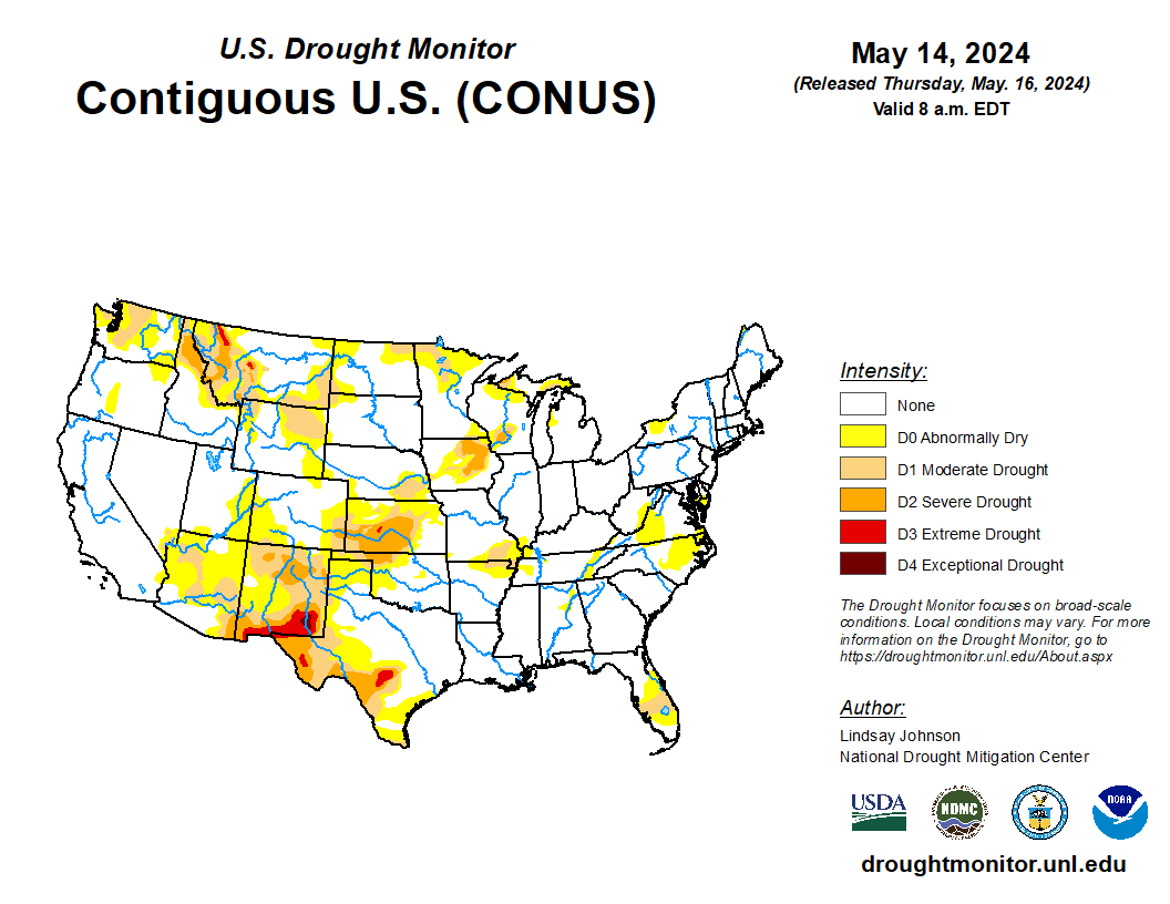
The spring storm currently moving into the southern Plains poses a threat of strong to severe storms and flash flooding over the next few days as it treks eastward across the lower Mississippi Valley. Three-day rainfall totaling greater than 1 inch is forecast from the southeastern Plains and western Gulf Coast into the Appalachians, with amounts greater than 4 inches possible from East Texas to southern Alabama. In contrast, sunny, progressively milder weather is forecast for the West through the end of the week, promoting planting of spring wheat, cotton, and rice. Meanwhile, lingering showers will likely maintain a relatively slow pace of corn and soybean planting in the Midwest. The NWS 6- to 10-day outlook for May 20 to 24 depicts near- to above-normal precipitation across much of the nation, with a high likelihood of wetter conditions over the central and northern Plains and Midwest. In contrast, drier weather is expected to dominate southern sections of New Mexico, Texas, and Louisiana. Temperatures will likely trend cooler than normal throughout much of the West, including the northern High Plains, while warmer conditions are expected in key southern and eastern farming areas, including the central and eastern Corn Belt.

