U.S. Weather/Crop Progress
Highlights:
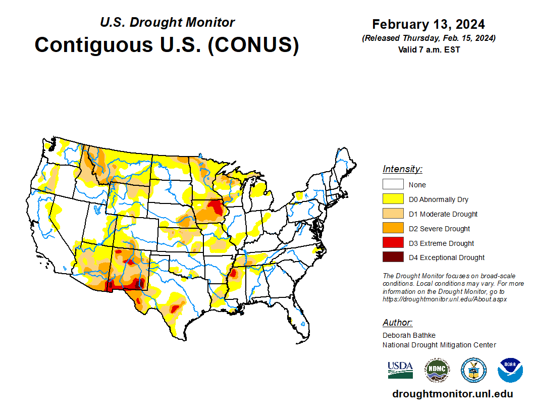
- In the West, storms are arriving in northern California and southwestern Oregon. Most other areas of the western U.S. are cool and dry. Many areas in the West have been abnormally dry this winter, with accumulations of less than 75% of normal.
- In the Plains states, colder conditions and light snow are hitting Montana and South Dakota. Further south, the weather is milder and drier.
- In the Corn Belt, temperatures remain near- to above-normal levels. Most of the Midwest has no snow cover remaining.
- In the South, pockets of lingering flooding remain from Mississippi to Georgia. Currently cool, dry weather covers the South, with light freezes occurring in some regions of the South.
Outlook:
A system crossing the northern U.S. is expected to produce snow from the Northern Plains to the Great Lakes by the middle of the week. That system is then expected to reach New England by Friday.
A separate larger system is currently moving inland along the Pacific Coast and is expected to produce significant precipitation in Oregon and California. The trailing storm will also move east quickly and is expected in the Ohio Valley by Friday, and to exit the Middle Atlantic Coast by Saturday. Cloudy, rainy weather is expected to linger behind the storm in the Gulf Coast region thought the weekend. Similar weather is also expected along the West Coast.
The NWS 6- to 10-day outlook for February 19-23 calls for the likelihood of near- or above-normal temperatures nationwide, except for cooler-than-normal conditions in the southern Atlantic region. Meanwhile, near- or above-normal precipitation across much of the eastern and western U.S. should contrast with drier-than-normal weather across most of the nation’s mid-section, as well as the Gulf Coast region.