U.S. Weather/Crop Progress
Highlights:
- In the Western U.S., above normal temperatures continue in advance of an approaching storm system. Precipitation and wind gusts hit parts of the Pacific northwest. The California Department of Water Resources reported the water equivalency of the Sierra Nevada snowpack is ~8.5 inches, approximately half its historical average for this time of the year.
- In the Plains states, snow continues to melt thanks to record temperatures.
- In the Corn Belt, the weather was dry and mild. Muddy conditions remain in parts of the Midwest due to recent rainfall combined with melting snow.
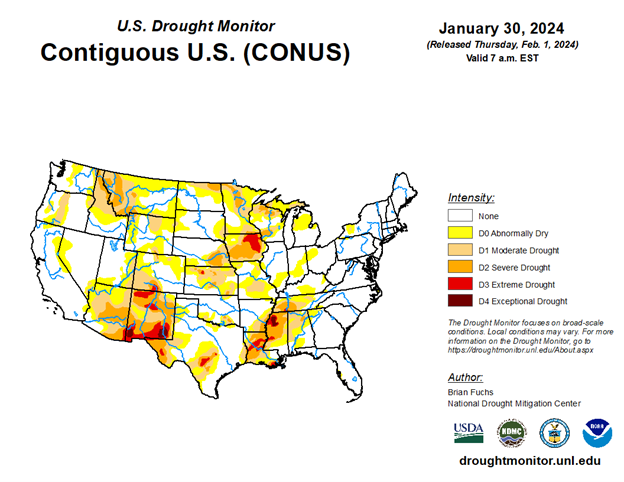
- In the South, warmer temperatures returned to the Western Gulf Coast. However, cooler conditions lingered in the Southeast. Precipitation in previous weeks is improving drought conditions throughout the South.
Outlook: A storm system arriving along the West Coast will affect the Pacific Coast states through Thursday before turning eastward and crossing the Southwest. Rain and possible snow will affect the central and southern Plains late in the week, followed by showers and thunderstorms in the Gulf Coast states during the weekend. A trailing storm system should reach California by Sunday. Five-day precipitation totals could reach 4 to 8 inches in coastal and mountainous areas of California, with light to moderately heavy amounts extending eastward to the Rockies and High Plains. Rainfall totals of 1 to 2 inches may fall across the South.
In contrast, mostly dry weather should prevail during the next 5 days across the Midwest and Northeast. Temperatures will remain significantly above normal at least through the weekend in much of the central U.S., while cooler air will begin to overspread the West.
The NWS 6- to 10-day outlook for February 5-9 calls for the likelihood of near- or above-normal temperatures and precipitation across much of country. Cooler-than-normal conditions will be confined to the southern Atlantic region and the Far West, while drier-than-normal weather should be limited to western Washington and an area stretching from the Gulf Coast to the southern and central Appalachians and the Northeast.