U.S. Weather/Crop Progress


Highlights:
- 60% of the corn is now in the dough stage or ear-fill stage. This is 14 points higher than a week ago, even with last year, and 4 points ahead of the 5-year average. Sorghum heading is at 73%, 5 points ahead of last year and 5 points ahead of the 5-year average. Barley harvest is underway with 18% harvested, up 11 points from last week, but behind last year and the 5-year average. Cooler than normal temperatures have slowed development. Soybean pod set is at 72%, up 13 points from last week, 3 points behind last year, but 2 points ahead of the 5-year average.
- The corn crop condition held steady this week with the Good/Excellent rating at 67%. This is the highest rating for mid-August since 2020. Sorghum condition improved a few points with the G/E category at 51%. 16% of sorghum is still rated poor to very poor condition due to excessive heat and dryness. The barley condition G/E rating dropped 3 points to 69%. The soybean condition rating was steady at 68% G/E.
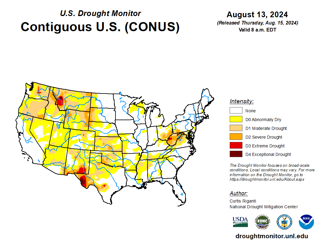
- In the West, drier air is overspreading the Rockies and Four Corners States, following a period of unsettled, showery weather. Meanwhile, several dozen Northwestern wildfires are in various stages of containment. So far this year, U.S. wildfires have burned some 5.4 million acres of vegetation, more than 125% of the 10-year average. Active Western wildfires account for more than 2.3 million acres of that year-to-date total.
- On the Plains, triple-digit heat continues to grip parts of Oklahoma and much of Texas, leading to stress on rangeland, pastures, and a variety of immature summer crops. On August 11, Texas led the Plains – tied with Montana – with 42% of its rangeland and pastures rated in very poor to poor condition. Meanwhile, mostly near- or below-normal temperatures, accompanied by lingering showers, cover the northern half of the Plains.
- In the Corn Belt, showers and thunderstorms sweeping across the Mississippi Valley are providing generally beneficial moisture for corn and soybeans. Early Thursday, some of the heaviest showers are scattered across Illinois and Missouri. In advance of the rain, warm, dry weather across the eastern Corn Belt is promoting summer crop development.
- In the South, hot, humid weather prevails, especially from the Mississippi Delta westward. However, dry weather across much of the region favors fieldwork, including early harvest activities. On August 11 in the Gulf Coast States, the corn harvest ranged from 8% complete in Alabama and Mississippi to 38% complete in Louisiana and Texas.
Outlook:
Northbound Hurricane Ernesto will remain well east of the continental U.S., but on Saturday will pass near or over the British Overseas Territory of Bermuda. Meanwhile, the cold front that will help to steer Ernesto away from the U.S. East Coast—currently traversing the Midwest—will march eastward, reaching the middle Atlantic Coast by Sunday. Additional Midwestern rainfall associated with the cold front should total 1 to 3 inches, with locally higher amounts, mainly from the Mississippi Valley eastward. Similar totals should occur during the weekend in the Northeast. Meanwhile, a record-setting heat wave will persist well into next week in the south-central U.S., including southern sections of the Rockies and Plains. Hot weather will also extend into the Desert Southwest and eastward into the Gulf Coast States, with oppressive humidity expected in the latter region. In contrast, cooler-than-normal conditions will cover the Corn Belt, maintaining generally favorable conditions for Midwestern corn and soybeans. The NWS 6- to 10-day outlook for August 19 – 24 calls for the likelihood of near- or above-normal temperatures and rainfall across much of the country. Notable exceptions will include cooler-than-normal conditions in the Pacific Northwest and from the middle and upper Mississippi Valley into the Northeast, along with drier-than-normal weather in a broad area stretching from southern sections of the Rockies and Plains into the lower Midwest.

