U.S. Weather/Crop Progress
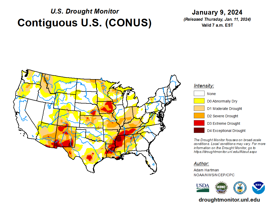
Highlights: ·
- In the Western U.S., cold and windy weather covers the north half of the region. Significant snow fell at higher elevations in the Northwest, with blizzard conditions occurring in several areas. Cold, dry conditions prevail in central and southern California and in the Southwestern U.S. Warnings of below freezing temperatures have been issued in parts of the Desert Southwest.
- In the U.S. Plains, significant snow remains on the ground, notably from South Dakota to Kansas, providing winter wheat with beneficial moisture and insulation ahead of an expected cold wave. Conversely, the southern Plains are largely snow free, while only patchy snow exists on the north High Plains, including Montana. Temperatures on the Plains are typical for this time of year, although colder air is amassing in western Canada.
- In the Corn Belt, mild weather is following a departing storm system. Wet, wind-blown snow fell Tuesday, primarily from the southwestern Corn Belt to Michigan. This led to increased stress on livestock and travel disruptions. Officially, January 9 snowfall in Iowa totaled 11.5 inches in Dubuque, 8.3 inches in Des Moines, and 7.8 inches in Devenport. Moline, Illinois received 6.8 inches.
Outlook: As one winter storm exits the East coast, another is arriving in the West. Areas affected by the previous storm will likely face similar conditions with a 3–4-day window between the storms. The new system will cross the central and southern Plains on Thursday into Friday, and the mid-South and Midwest from Friday into Saturday. The storm’s trailing cold front will sweep across the South on Friday and exit the Atlantic Coast by Saturday. Bitter cold will trail the storm, with temperatures early next week expected to plunge below 0°F as far south as Texas’ northern panhandle. Sub-zero temperatures will also cover the Midwest, while hard freezes (28°F or below) will spread into Louisiana’s sugarcane areas. Meanwhile, weekend temperatures below -30°F will affect the northern High Plains. The NWS 6- to 10-day outlook for January 15-19 calls for the likelihood of colder-than-normal conditions nationwide, except for near- or above-normal temperatures in California and the Desert Southwest. Meanwhile, near- or below-normal precipitation across much of the U.S. should contrast with wetter-than-normal weather in southern Texas, northern New England, the lower Southeast, and areas downwind of the Great Lakes, as well as an area stretching from northern California and the Pacific Northwest to the northern High Plains.

